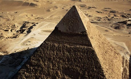
Archaeologist Sarah Parcak says she has discovered thousands of ancient sites in Egypt, from pyramids to a detailed street plan of the city of Tanis, an A-to-Z of the region's northern capital – all thanks to images from satellites orbiting 400 miles above the Earth. The infra-red pictures are capable of tracing structures buried deep in the sand. "It just shows us," she adds, "how easy it is to underestimate both the size and scale of past human settlements."
Parcak had studied at Cambridge and taught in Swansea before returning to the US, where she is now at the University of Alabama at Birmingham. Her special interest is analysing satellite images for unseen archaeological remains, and she's on to a winner. In theory there's not much you can see from a satellite that you can't from an aeroplane – and with today's technologies, there is a very great deal you can find from both. But in practice, the satellites, with publicly available image libraries, score in reduced cost and in reaching inaccessible areas, such as Egyptian deserts, Easter Island . . . and Wales.
Wales? In 2009 a stone-walled ancient fish trap was spotted on Google Earth in the Teifi estuary. The ancient landscape of Britain is laid out before us as never before. One of the first archaeological satellite studies showed prehistoric earthworks near Stonehenge; these had already been mapped, but we make real discoveries as we tour the globe.
In the near east and in Siberia, 3D images are helping to understand remote landscapes and archaeological sites. The roads on which the statues were moved across Easter Island have now been mapped. And in Peru vast ancient "geoglyphs" have been seen, land art in the form of animal shapes created when people moved earth and stones about. The last is a warning. Last year Amelia Carolina Sparavigna, a physicist in Turin, claimed to see birds and snakes outlined in the sinuous walls and field boundaries of ancient landscapes around Late Titicaca. These designs would never have been visible from the ground, and even from above require much faith as you pick along one wall and ignore many others to end up with a very wobbly looking fauna (mysteriously including a hedgehog).
Satellites are powerful tools. At the end of the day, though, you still need to get down on your knees before you can be really sure what you are seeing.
For more interesting topics related to archaeology, visit archaeology excavations.
No comments:
Post a Comment